GeoKnow › Printables › Map of China and Its Neighbours
Map of China and Its Neighbours: Printable
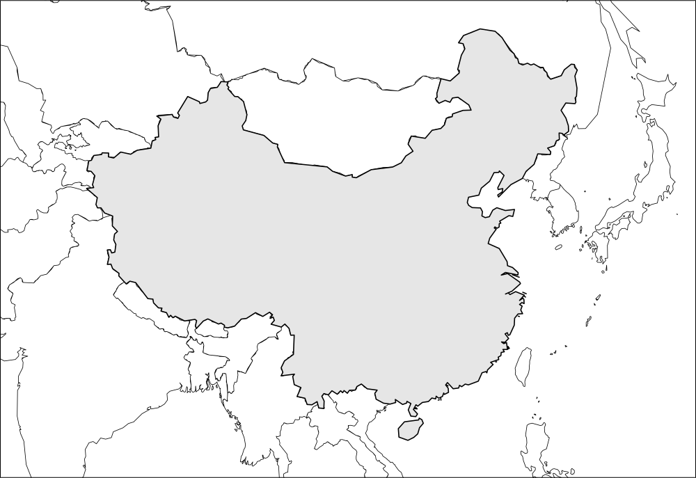
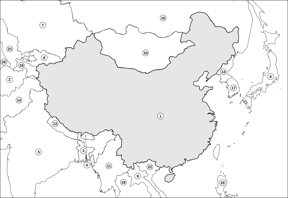
A printable outline map of China shown with the countries around it. Three sheets: a plain blank map, a numbered worksheet where pupils name China and its neighbours, and an answer key.
China's capital is Beijing. It shares a land border with 14 countries: Afghanistan, Bhutan, India, Kazakhstan, Kyrgyzstan, Laos, Mongolia, Myanmar, Nepal, North Korea, Pakistan, Russia, Tajikistan, Vietnam.
Sheet: Blank map of China and neighbouring countries
Sheet: Label China and its neighbours
Answer key: China and its neighbours: answer key
Download
Ideas for using this map
- Name the neighbours. Pupils fill in the numbered worksheet from an atlas, then check with the key.
- Add the detail. On the blank sheet, mark the capital (Beijing), main rivers, mountains or a route.
- Link to games. Once pupils know the shape, test it in the country outline quiz, then try Neighbour Rush and Border Run for neighbours.
Read the full facts on the China page for capital, population and borders.
How to print
Press the print button, then choose A4 or Letter in the print dialog and keep the scale at 100% (not "fit to page" with extra margins). Each sheet is designed to fill one page with a small margin on either size, and your browser's headers and footers can be switched off in the same dialog. Prefer a file? Download the PDF at the top.
Country pages for this map
China Afghanistan Bangladesh Bhutan India Japan Kazakhstan Kyrgyzstan Laos Mongolia Myanmar Nepal North Korea Pakistan Philippines Russia South Korea Tajikistan Thailand Turkmenistan Uzbekistan Vietnam
Play it online
Learned it on paper? Try it as a game: country outline quiz, Neighbour Rush, Border Run. All of them are free, with no sign-up.
More printables
Map of United States Map of Canada Map of Mexico Map of Brazil Map of Argentina Map of United Kingdom Map of France Map of Germany Map of Italy Map of Spain Map of India Map of Japan Blank world map
Questions
Does the map of China show its neighbours?
Yes. The map is framed around China and includes the surrounding countries so pupils can learn the whole neighbourhood. China is outlined in a heavier line and shaded light grey.
Is there an answer key?
Yes. The last sheet is the answer key and it is the last page of both PDF downloads.
Does it print on A4 and US Letter?
Yes, at 100% scale on either paper size.
Maps are drawn from Natural Earth (public domain) outline data and simplified for printing. Borders shown are simplified and some are disputed or changing; GeoKnow maps are learning aids, not authoritative boundary references, and showing a territory does not imply any position on its status. Spotted a mistake? Tell us. Free for home and classroom use. A link back to geoknow.org/printables is always appreciated if you share them.